Not before October 25 — Maryland listings go public that day, when PickRV opens for bookings. Give us your travel dates a few lines below, and you get one email the day a rig covers your window — the owner's own nightly price, with the 10% service fee and any tax itemized before you pay.
How renting in Maryland works
Maryland listings go public on October 25 — one email the day that happens
The listed price is the full, all-in owner rate — no drip pricing
You choose the coverage — your own policy or the owner's, agreed before pickup
48-hour full rental refund; refund eligibility for confirmed government evacuation orders is reviewed per booking and disclosed at checkout
You collect the rig from its owner, not a rental counter — the exact address is confirmed with the booking
By PickRV·Cited primary sources·Updated September 24, 2026
Maryland is the only US state where a single 4-hour drive can take an RV from the Atlantic coast (Assateague Island National Seashore + the only US national seashore with wild horses on both barrier islands, NPS) to a mountain summit at 3,360 ft (Backbone Mountain, Hoye-Crest, the highest point in Maryland — Garrett County).
Maryland for RV travelers, from the sources
Campsites in Maryland state parks and forests
More than 2,000
The Maryland Park Service offers more than 2,000 campsites, 120 full-service and camper cabins, and 100 picnic shelters to guests.
Maryland's state parks offer a camping experience for everyone - from campgrounds with electric, sewer and water hookups and showers, to primitive camping in state forests.
When to go: April to June and September to October
Mild spring and fall avoid summer humidity and winter chill; Chesapeake Bay and mountains are pleasant.
Watch out: Hurricanes and nor'easters can affect the coast. Summer humidity and occasional severe storms occur.
Tell us when you want to drive Maryland.
Maryland listings go public on October 25, the day PickRV opens for bookings. Give us the window you actually want — you get one email the day a rig covers it, and nothing else.
Not before October 25 — Maryland listings go public that day, when PickRV opens for bookings, and we would rather say that than send you to an empty results page. Tell us your travel dates on this page and you get one email the day a Maryland rig covers your window, with the owner's own nightly price itemized before you pay.
Each host in Maryland sets their own nightly rate, so pricing depends on the rig: smaller travel trailers typically rent for less, Class C motorhomes sit mid-range, and larger Class A motorhomes cost more. Your exact total — the rental, the 10% service fee and any tax — is itemized before you pay. No surprise fees.
PickRV is not an insurer and does not sell coverage. Trips run on the coverage you and the host agree on before pickup — your own personal auto / RV policy where it covers rental use, or the host's own commercial policy per their certificate of insurance. Confirm with your insurer before the trip.
The platform default is Moderate: full refund up to 48 hours before pickup. Hosts can set Flexible (full refund until 24 hours out, half even same-day) or Strict (full refund until 7 days out) on their own listing, and the tier is shown before checkout. Tax (standard state rate) auto-refunds with the booking.
Can I take an RV off-road in Maryland?
Most Maryland listings are paved-road only per owner terms. Off-road-rated rigs (Class B and converted Sprinters) show an off-road rider on the listing when an owner offers one.
The Maryland field guideRoads, parks and what the official pages leave out
The Maryland signature
Cherry blossom, played as a basecamp
The Tidal Basin has zero parking — which makes Maryland the smart play: NPS calls peak bloom in early March, and Metro-accessible basecamps put you under the petals without ever circling downtown.
Window
Peak late Mar–early Apr · NPS prediction each early Mar
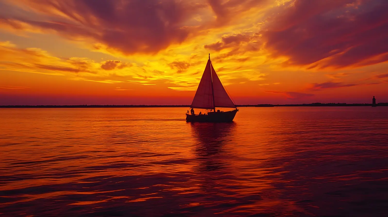
Classic skipjack sailing the Chesapeake Bay, Maryland
Maryland trips cluster around Baltimore (the I-95/I-695 + Inner Harbor hub), Ocean City + Assateague (Atlantic basecamp), and Western Maryland (Deep Creek Lake — the largest freshwater lake in the state). Vehicle culture leans Class B campervan + boat-trailer combos because both Chesapeake Bay sailing AND mountain backcountry are within a 3-hour drive of every Maryland pickup.
What this state demands of your rig
Maryland caps non-commercial RVs at 13 ft 6 in height + 8 ft 6 in width (Maryland Transportation Article §22-417).
The Chesapeake Bay Bridge (US-50/301, Bay Bridge — Maryland Transportation Authority) accepts RVs at standard toll rate but the eastbound span is 4.3 mi of bridge deck with no shoulder; pull-overs are emergency-only.
The Harriet Tubman Underground Railroad National Historical Park scenic loop (NPS) accepts rigs up to 35 ft. Maryland state-park generator hours are 10 PM – 8 AM (Maryland DNR).
Assateague Island camping (NPS, oversand vehicle permit) requires 4WD with mandatory equipment; standard rental motorhomes are not equipped — towables only for oversand.
When to come
Best window: April through October. Summer (June–August) hits 88°F + Chesapeake humidity. Atlantic hurricane season (June–November per NOAA NHC) can affect Ocean City + Assateague — confirmed evacuation orders activate US-50 westbound.
Fall foliage in Western Maryland (Garrett County + Allegany County) peaks October 15-25.
Maryland State Fair (Timonium, late August + Labor Day) and the Preakness Stakes (Pimlico, third Saturday of May) are the two largest demand spikes for Baltimore-area RV rentals.
The 2024 total solar eclipse partially crossed Maryland (~85 % coverage); 2026-2028 paths do not include Maryland totality.
How to think about your trip
Classic 7-day Maryland loop: Baltimore (Inner Harbor + American Visionary Art Museum + Federal Hill) → Annapolis (US Naval Academy + the State House — oldest continuously operating state capital in the US) → St Michaels (Chesapeake Bay Maritime Museum) → Easton → Cambridge → Assateague Island National Seashore (NPS — wild horses) → Ocean City → return via US-50 → Washington DC area (Smithsonian-adjacent campgrounds Greenbelt + Cherry Hill Park) → return Baltimore.
For Western Maryland: a separate 4-day loop based out of Frederick → Cumberland (C&O Canal towpath, US Bicycle Route 50) → Deep Creek Lake → return.
Three things only Maryland can claim
Assateague Island National Seashore is the only US national seashore with wild horses on both Maryland AND Virginia sides (NPS — separate herds managed under different agreements)
Annapolis State House is the oldest continuously used state capital in the US (commissioned 1772) — it served as the US Capitol November 1783 – August 1784 (Maryland State Archives)
The Chesapeake Bay is the largest estuary in the US (4,479 sq mi — Chesapeake Bay Program, US EPA) and produces approximately 500 M lbs of seafood annually
How Maryland breaks down regionally
Three Marylands. Eastern Shore (Atlantic + Chesapeake): Ocean City, Assateague, St Michaels, Easton — wild horses + Chesapeake oysters + colonial maritime culture. Central (Baltimore + Annapolis + DC suburbs): Inner Harbor, Smithsonian access, US Naval Academy, Fort McHenry (NPS — birthplace of the Star-Spangled Banner). Western (Frederick + Cumberland + Garrett County): Catoctin Mountain Park, C&O Canal towpath, Deep Creek Lake, Appalachian Trail crossings.
Signature routes
Chesapeake Country Scenic Byway MD-213
Chestertown → Centreville → Stevensville (~85 mi past the Bay Bridge on the Eastern Shore)
Historic National Road US-40
Baltimore → Frederick → Cumberland → western MD line (~170 mi along the original 1811 federal road)
Mountain Maryland Scenic Byway US-219 + US-50
Garrett County loop (~152 mi past Deep Creek Lake)
Catoctin Mountain Scenic Byway US-15 + MD-77
Frederick → Thurmont → Cunningham Falls State Park (~32 mi)
Baltimore pickup keeps you 90 minutes from the Atlantic and 2 hours from the Appalachian foothills — browse Maryland rentals on PickRV and size your rig for the Bay Bridge and Assateague oversand restrictions.
Maryland events 2026-2028, official dates · 3Show eventsHide events
Maryland open-container law (Transportation Article §21-903) prohibits open alcoholic containers in the passenger area of a motor vehicle. Recreational marijuana is legal under Maryland law (effective July 1 2023) — possession up to 1.5 oz permitted for adults 21+; consumption in a moving vehicle prohibited. Hurricane evacuation routes are signed along US-50 + US-13; consult NHC + Maryland Emergency Management Agency before coastal travel June–November. Bay Bridge crosswind warnings post regularly; high-profile vehicles may be restricted in sustained 50+ mph wind.
What other Maryland guides don't tell you · 3Show insightsHide insights
Insider tip: Assateague Island NPS (the only US national seashore with wild horses on both MD + VA sides per nps.gov/asis) wild-horse viewing is best at dawn near the Visitor Center loop. The under-shared truth: the State Park side (Assateague State Park, MD DNR) has full hookups + showers; the NPS side has primitive ocean-side sites with no hookups but virtually unlimited horse viewing — booking BOTH for a 2-night split delivers the full Assateague experience.
Insider tip: Chesapeake Bay Bridge (US-50, mdta.maryland.gov) eastbound 4.3-mi span has no shoulder + frequent crosswind warnings — sustained 50+ mph wind triggers high-profile vehicle restrictions per Maryland Transportation Authority. The under-shared truth: the Bay Bridge has a free 24-hour 'wind status' phone line (1-877-BAYSPAN) AND an X (Twitter) @TheBayBridge live update feed — checking before Friday afternoon eastbound departures during summer thunderstorm season prevents 3-hour bridge-closure delays.
Insider tip: Harriet Tubman Underground Railroad NHP (NPS — Cambridge MD per nps.gov/hatu) is FREE admission AND the Visitor Center anchors the Harriet Tubman Underground Railroad Scenic Byway (36-stop drive). The under-shared truth: the Tubman Center is open 9-5 Tue-Sun BUT the byway sites along MD-335 + MD-16 are open dawn-dusk year-round AND the Bucktown General Store (where Harriet's first act of defiance occurred at age 13) is a 7-minute drive from the Visitor Center.
The Bay Bridge wind math, Assateague's no-hookup reality, the OSV gear checklist, and the plover closures that brochures skip.
The Bay Bridge bans empty trailers and house trailers at 40 mph wind — your rig can get stranded
The Chesapeake Bay Bridge (William Preston Lane Jr. Memorial Bridge, US-50/301) runs a tiered wind system. At 'Limited Wind Restrictions' (sustained 40-49 mph), house trailers and empty box trailers are flat-out prohibited from crossing; at 'Full Wind Restrictions' (50+ mph) only cars, pickups, flatbeds and heavy tractor-trailers get through, and the MDTA may close the bridge entirely above 55 mph. Two-way operations are also suspended during any wind warning, fog or rain. A travel-trailer or high-profile motorhome can be turned around at the toll plaza on a gusty day, so check baybridge.maryland.gov before you commit to the eastbound crossing.
Source: Maryland Transportation Authority (MDTA) — Bay Bridge emergency closures
Assateague Island's NPS campground has ZERO hookups and only cold-water showers
The Assateague Island National Seashore campground (the bayside/oceanside loops run by the NPS) takes RVs but has no electric, water or sewer hookups at any site, plus chemical toilets and seasonal COLD-water showers only, available mid-March through mid-November. Note this is the federal NPS campground, not the adjacent Assateague State Park. Bring full fresh-water and a plan for your tanks, because there is no shore power to run the AC and no hot shower on the entire spit.
Source: NPS — Assateague Island National Seashore (Maryland camping)
Even the neighboring State Park only has 30-amp electric — no water or sewer at the site
Assateague State Park (Maryland DNR, the park just north of the NPS land) has 342 campsites, but 30-amp electric hookups exist only in the G-Loop and I-Loop; no site has water or sewer hookups, so you fill from shared spigots and use the central dump station. Reservations open 365 days out and the season runs roughly the last week of April through the last weekend of October. Book the electric loops the day the window opens — they are the only powered sites on the island and they vanish fast.
Source: Maryland DNR — Assateague State Park
Beach driving requires a documented gear kit — and the Maryland sand zone caps at 145 vehicles
To drive the Maryland Over-Sand Vehicle (OSV) zone you need a $110 annual permit AND must carry, for ranger inspection, a non-plastic shovel (6" blade, 18" handle), a jack, a 12"x12" jack support board, a tire gauge that reads down to 15 psi, and a 10-ft tow rope/strap rated 6,000+ lb. Air down to 15-20 psi at the entrance station. The Maryland zone is hard-capped at 145 vehicles; once full, an automated gate runs one-off/one-on, so a summer-weekend arrival can mean waiting in line on the pavement.
Source: NPS — Assateague Island National Seashore OSV use & permits
Maryland's 2-5.75% bracket plus county piggyback + the C&O Canal towpath make it the natural Chesapeake → Blue Ridge → OBX pivot
Maryland runs a graduated personal income tax from 2.0% to 5.75% on net rental (Comptroller of Maryland, 2026 brackets) PLUS a mandatory county/Baltimore-City piggyback ranging from 2.25% (Worcester) to 3.20% (Howard, Montgomery, Prince George's) — so a Bethesda-based owner effectively pays roughly 8.95% combined, the highest in the mid-Atlantic. The 184.5-mile C&O Canal NHP towpath runs Washington DC to Cumberland, MD with NPS hiker-biker campsites at every 5-7 miles (free, no permit, water seasonal). The natural multi-state path west out of an Eastern Shore pickup: Bay Bridge into Annapolis (mind the 40 mph wind cap, fact above) → I-70 west to Cumberland → Skyline Drive south onto /road-trips/blue-ridge-parkway-7day/ via Front Royal VA. South alternative: US-50 east to Ocean City → onto /road-trips/obx-cape-hatteras-5day/ via the Bay Bridge-Tunnel into Virginia.
Source: Comptroller of Maryland — Individual Income Tax (state + county piggyback 2026); NPS C&O Canal National Historical Park
Top experiences in Maryland
Public-land, state-park, and scenic-route entries sourced from official .gov and agency sites. Links open the operator’s page.
Wild horses and 37 miles of beach define this barrier island; oceanside and bayside campgrounds are open year-round with limited services and mosquito reality.
The presidential retreat (Camp David) sits inside this northern Maryland NPS unit; Owens Creek Campground serves tents and small RVs in the Catoctin Mountains.
Maryland's largest freshwater lake sits in the western panhandle; RV-accessible camping, a marina, and the surrounding Appalachian forest define the park.
The 184-mile towpath and restored locks follow the Potomac from Georgetown to Cumberland; hiker-biker campsites every few miles are the only overnight options inside the park.
The Eastern Shore's marshes, historic ports, and the Choptank River define this National Scenic Byway; small parks and B&Bs are the practical RV stops.
RV regulatory notes for Maryland
Maryland MVA uses weight-class fees for motor homes plus a 6% excise tax at titling on fair market or purchase price. The weight + excise combo hits heavier luxury rigs especially hard at first titling. Data as of June 2026 — use the MVA estimator with your exact weight and purchase price.
Informational only. Confirm fees and requirements with the registering agency before traveling; rules change.
What an RV rental costs in MarylandNightly ranges by rig class and what moves them
Budget by class
RV rental prices in Maryland
National public-market medians; every Maryland listing sets its own price.
Every Maryland owner sets their own nightly rate, and the listed price already includes everything they charge for the rig itself. At checkout your exact trip total is itemized before you pay — the rental, a transparent 10% service fee and any tax. The per-class figures below are what rigs of that size rent for nationally; use them to size a budget, not to price a specific Maryland trip.
Public-market nightly medians (NADA + RVTrader listings) — not PickRV booking data. The exact price for your dates is shown on every listing before you book.
Maryland rules, laws and sourcesTowing, overnight parking and where each rule comes from
State rules
Maryland — what to know before you book
Last verified 2026-05-10
State rental tax
7%
6% state tax + 1% avg local · estimated — statute verification in progress · exact tax confirmed at checkout · PickRV does not collect this — your host is responsible for state and local tax.
Min driver age
21+ standard · 25+ Class A
Gravel road policy
Allowed — disclosure required
Generator quiet hours
22:00-07:00
OHV permit
Required · ~$30
Alcohol policy
Open container prohibited in cabin
Dump-station regulations
Standard enforcement
Must know
›PickRV per-state rules data is being verified for this state — defensible defaults applied
Compliance notes (1)
· Renter must verify state-specific rules before pickup
Per-state legal callout · MD
Before you rent in Maryland — key local rules
Personal motorhomes under 26,001 lbs need no special license
Md. Code, Transportation §16-104.1(c): a noncommercial Class C license (Maryland's standard license) authorizes driving any vehicle or combination under 26,001 lbs GVWR (excluding CMVs and motorcycles); §16-104.1(b) requires a noncommercial Class B license for single vehicles or combinations of 26,001 lbs and more.
Wolf Den Run State Park + western state forests carry the ORV trails
Maryland's off-road riding is on public land: Wolf Den Run State Park in Garrett County has 12.5 mi of motorized trail (6.5 mi of it open to full-size vehicles) plus the state's only Jeep Badge of Honor Trail, and Potomac-Garrett and Savage River state forests carry designated ORV trails. ORVs may be used on state forests and parks only on those designated trails, and every vehicle needs a DNR OHV sticker and/or Maryland MVA registration. Rausch Creek Off-Road Park, often listed alongside Maryland riding, is across the line in Pennsylvania.
0.08% BAC; only the driver is barred from drinking in the vehicle
Maryland's per se limit is an alcohol concentration of 0.08 or more (Transp. §11-174.1, enforced under §21-902). Statewide law bars only the driver from consuming alcohol, or smoking or consuming cannabis, in the passenger area on a highway — there is no statewide ban on simply carrying an open container, and no restriction on passengers. County and city ordinances can add their own open-container rules, so check locally before you travel.
This guide is provided for general informational purposes only. PickRV is not an insurer, legal advisor, or vehicle-safety authority. Trip planning, route selection, rig suitability, weather, and emergency decisions are the renter's responsibility. Always consult the rig manufacturer's owner's manual, your insurance provider, the U.S. National Park Service (nps.gov), NOAA / NWS weather alerts (weather.gov), state and local emergency-management agencies, and current local regulations before and during travel. Cost figures, season windows, road conditions, and fee references on this page are estimates as of May 2026 and vary by season, location, rig, carrier, and operator. Mentions of brand names, state-tourism marks, national-park feature names, or third-party programs are informational only and do not imply affiliation, sponsorship, or endorsement.