Room to spread out
National Recreation Areas for RV Travelers
America's national recreation areas and lakeshores — big reservoirs, dune fields, and river corridors built for getting outside, with what each area offers, when to go, and where to camp your rig. Facts are sourced from official agency pages.
Marinas, campgrounds, and boat ramps open seasonally — check the official recreation-area page before you go.
- 16
- Field guides
- 14
- States covered
- 16
- Official sources cited
The recreation areas
Every recreation area in the guide
Michigan
Sleeping Bear Dunes National Lakeshore
Michigan
Sleeping Bear Dunes National Lakeshore: An RV Traveler's Guide
Sleeping Bear Dunes National Lakeshore features towering bluffs and dunes rising roughly 450 feet above Lake Michigan, plus miles of beach and inland lakes. RV campers can choose between Platte River Campground (electric hook-ups, showers, modern restrooms) and the rustic D.H. Day Campground, both drive-in options. Located in Empire, Michigan, the park offers a peaceful escape with dramatic coastal scenery.
Read the field guideWisconsin
Apostle Islands National Lakeshore
Wisconsin
Apostle Islands National Lakeshore: An RV Traveler's Guide
This lakeshore features 21 islands and a 12-mile mainland shoreline on Lake Superior. Camping is available on 18 islands via boat or water access, plus a few mainland sites near Meyers Beach; no drive-in RV camping exists. Renowned for sea caves, lighthouses, and rugged natural beauty, the area offers a uniquely remote, water-bound experience managed by the National Park Service.
Read the field guide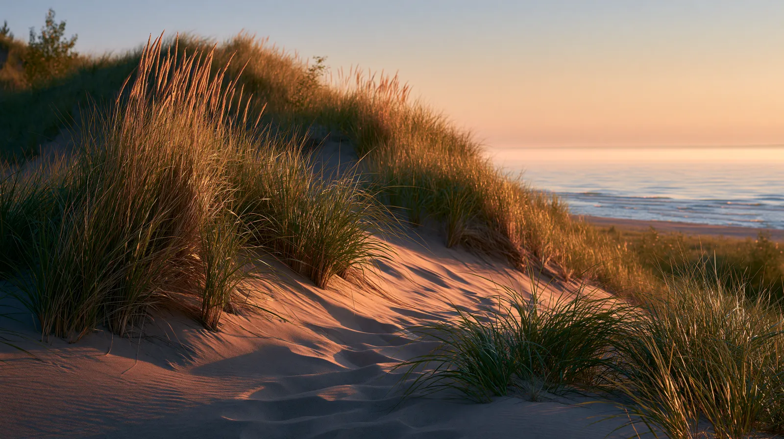
Indiana
Indiana Dunes National Park: An RV Traveler's Guide
Indiana Dunes National Park protects a stretch of Lake Michigan shoreline defined by its iconic sand dunes and a mosaic of ecosystems. With over 50 miles of trails winding through dunes, forests, and wetlands, it’s a hiker’s haven. The park’s Dunewood Campground offers drive-in sites for RVs and tents (no hookups, dump station available, some length limits) from April through October—a perfect base for exploring this lakeside gem.
Read the field guideColorado
Curecanti
Colorado
Curecanti National Recreation Area: An RV Traveler's Guide
Curecanti National Recreation Area spans the Gunnison River with three distinct reservoirs: Blue Mesa, Morrow Point, and Crystal. The area is renowned for boating, fishing, and hiking along rugged cliffs and serene waters. Ten campgrounds provide options for overnight stays, most with fees. Whether you're seeking a peaceful paddle or a family camping trip, Curecanti delivers a memorable mountain experience.
Read the field guideOklahoma
Chickasaw
Oklahoma
Chickasaw National Recreation Area: An RV Traveler's Guide
Chickasaw National Recreation Area is a water-centered park in Oklahoma, known for its springs, streams, and lakes—especially the large Lake of the Arbuckles. RV campers can choose from developed campgrounds with hookups (Buckhorn, The Point) or simpler spots for smaller rigs. Located near Sulphur, it's a beloved destination for swimming, boating, and unwinding in nature.
Read the field guideWashington
Lake Roosevelt
Washington
Lake Roosevelt National Recreation Area: An RV Traveler's Guide
Lake Roosevelt National Recreation Area centers on the 150-mile-long reservoir formed by Grand Coulee Dam on the upper Columbia River in northeast Washington. The recreation area offers developed standard campgrounds with vehicle and RV access (no hookups), plus dump and fill stations at eight locations. Visitors enjoy boating, fishing, swimming, and exploring the dramatic shoreline and surrounding high desert scenery.
Read the field guideTexas
Amistad
Texas
Amistad National Recreation Area: An RV Traveler's Guide
Amistad National Recreation Area is a water-focused desert gem managed by the National Park Service. Its defining feature is the massive International Amistad Reservoir, shared with Mexico, offering a large, open-water playground for boating, fishing, and paddling. Vehicle-accessible, first-come, first-served campgrounds (Governors Landing, Rough Canyon, San Pedro, Spur 406, and 277 North) accommodate RVs with no hookups but a handy dump station. The Chihuahuan Desert setting means warm days, cool nights, and sweeping views of limestone cliffs and blue water.
Read the field guideMontana & Wyoming
Bighorn Canyon
Montana & Wyoming
Bighorn Canyon National Recreation Area: An RV Traveler's Guide
Straddling the border of Montana and Wyoming, Bighorn Canyon National Recreation Area encompasses over 120,000 acres of canyon country and the long, winding Bighorn Lake reservoir. The recreation area is defined by the steep cliffs of Bighorn Canyon and the deep blue waters of the lake, creating a striking backdrop for outdoor activities. Visitors can enjoy water-based recreation on the reservoir or explore the canyon's rugged trails and viewpoints.
Read the field guideCalifornia
Whiskeytown
California
Whiskeytown National Recreation Area: An RV Traveler's Guide
Whiskeytown National Recreation Area is a 42,000-acre gem defined by Whiskeytown Lake. The reservoir’s iconic clarity and beauty anchor the park, with waterfalls and trails embracing its shores. RV camping is available at Oak Bottom Campground, where drive-in sites place you steps from the water. It’s a straightforward, nature-filled escape where the lake is always the main attraction.
Read the field guideNew Jersey & Pennsylvania
Delaware Water Gap
New Jersey & Pennsylvania
Delaware Water Gap National Recreation Area: An RV Traveler's Guide
Managed by the National Park Service, Delaware Water Gap National Recreation Area protects a 40-mile stretch of the Delaware River along the New Jersey and Pennsylvania border. The river is celebrated as the longest free-flowing river east of the Mississippi, offering deep, clear water and a winding shoreline. RV campers can stay at developed campgrounds such as Dingmans Campground, while primitive river camping is limited to water access. This recreation area delivers a blend of river adventure and forest tranquility.
Read the field guideMichigan
Pictured Rocks National Lakeshore
Michigan
Pictured Rocks National Lakeshore: An RV Traveler's Guide
This National Park Service site showcases the dramatic Pictured Rocks cliffs—up to 200 feet high—carved by Lake Superior over millennia. Miles of hiking trails lead to remote beaches, lighthouses, and waterfalls like Munising Falls and Chapel Falls. The park’s mosaic of dunes, wetlands, and boreal forest hosts black bears, moose, and peregrine falcons. Scenic boat tours offer the best views of the cliffs’ vivid colors.
Read the field guideCalifornia
Golden Gate
California
Golden Gate National Recreation Area: An RV Traveler's Guide
One of the world’s largest urban national parks, Golden Gate National Recreation Area preserves a mosaic of ecosystems and historic sites along 60 miles of California coastline. From the towering redwoods of Muir Woods to the windswept bluffs of the Marin Headlands, the park invites exploration of tide pools, beaches, and old military batteries. It’s a place where nature and history intertwine just minutes from downtown San Francisco.
Read the field guideCalifornia
Santa Monica Mountains
California
Santa Monica Mountains National Recreation Area: An RV Traveler's Guide
This National Recreation Area encompasses a mountain range rising from the Pacific Coast, with nearly 40 miles of shoreline, deep canyons, and a Mediterranean climate. It’s a haven for hikers, beachgoers, and wildlife enthusiasts, protecting endemic plants and animals while linking urban Los Angeles to wild open spaces through a network of trails, state parks, and undeveloped habitat.
Read the field guideWashington
Ross Lake
Washington
Ross Lake National Recreation Area: An RV Traveler's Guide
Ross Lake NRA encompasses the upper Skagit River valley and the long reservoir impounded by Ross Dam. Part of the North Cascades National Park Complex, it serves as a scenic corridor for paddling, fishing, camping, and wildlife watching beneath a dramatic alpine backdrop. The lake reaches into Canada, and its remote shoreline is a magnet for kayakers, canoeists, and hikers seeking solitude among ancient cedars and glacially fed waters.
Read the field guideNew York & New Jersey
Gateway
New York & New Jersey
Gateway National Recreation Area: An RV Traveler's Guide
Stretching from Breezy Point in Queens to Sandy Hook in New Jersey, Gateway combines barrier beaches, dunes, woodlands, and wetlands. Visitors find peaceful hiking trails, historic lighthouse views at Sandy Hook, the Jamaica Bay Wildlife Refuge for birdwatching, and the former military fortifications of Fort Tilden and Fort Hancock. The park shelters diverse wildlife and offers a surprising sense of remoteness just minutes from Manhattan.
Read the field guideGeorgia
Chattahoochee River
Georgia
Chattahoochee River National Recreation Area: An RV Traveler's Guide
Flowing from Lake Lanier’s Buford Dam south toward Atlanta, the Chattahoochee River here is a designated National Recreation Area. With multiple access points, visitors can float the river by kayak or tube, cast for trout and bass, or hike miles of riverside trails through hardwood forests. The park protects natural shoreline, historic mill ruins, and deep pools, offering a refreshing backdrop for outdoor recreation minutes from city life.
Read the field guide
Where the water gathers
Recreation-area country, state by state
National recreation areas cluster around the West's big reservoirs and river corridors, with more along the Great Lakes and eastern lakeshores. Pick a state to see RV rentals and what else is nearby.
Planning a lakeside week with the rig?