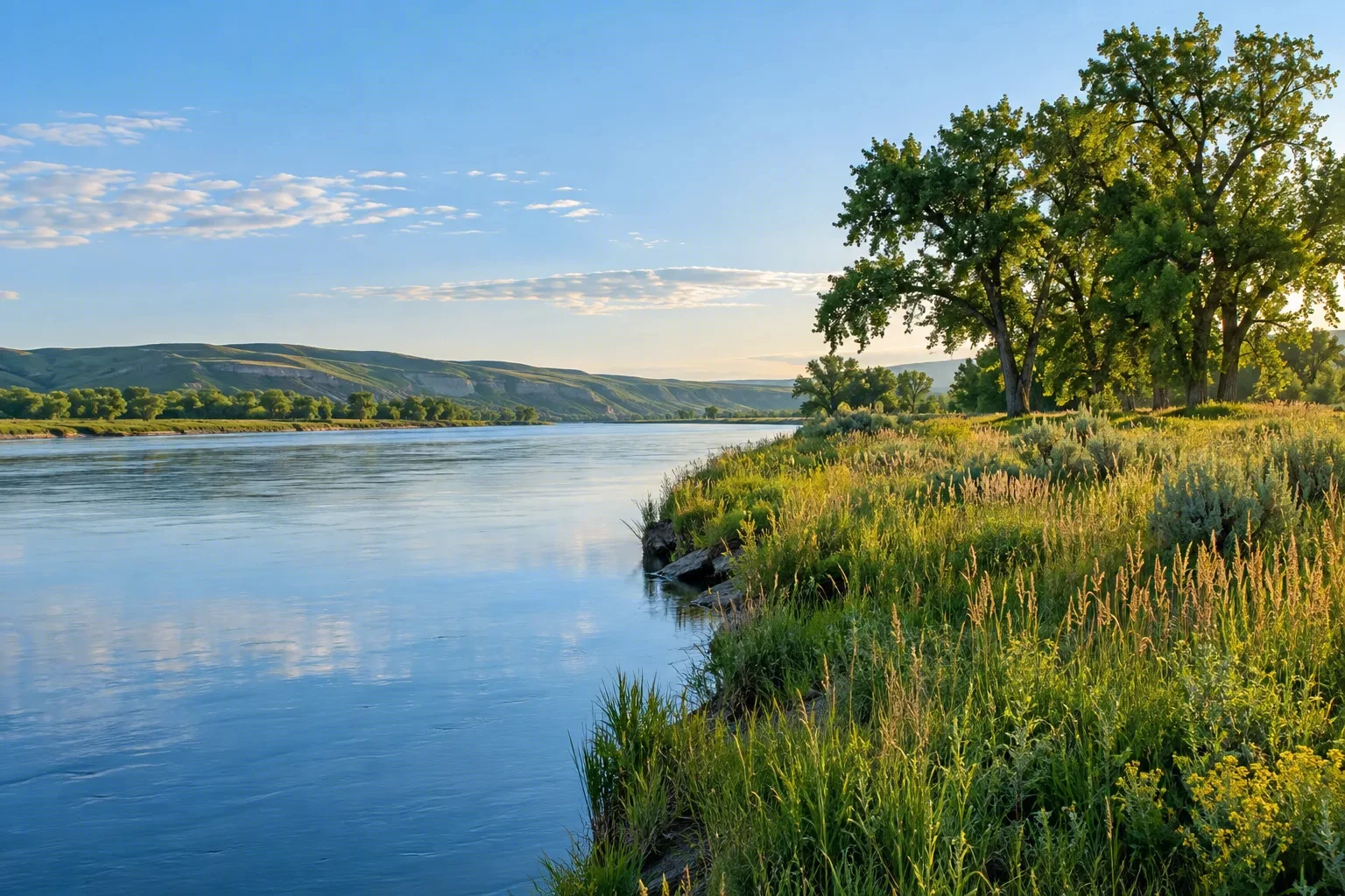
Formed by the confluence of the Lochsa and Selway rivers at Lowell, the Middle Fork Clearwater cuts a deep, forested canyon through north-central Idaho. As one of the original eight rivers designated under the Wild and Scenic Rivers Act on October 2, 1968, it protects a pristine flow cherished for its steelhead and trout fisheries, thrilling whitewater, and untouched riparian habitat. The river corridor, managed by the U.S. Forest Service within the Nez Perce-Clearwater and Bitterroot National Forests, reveals ponderosa pine benches and basalt cliffs. RV travelers follow Highway 12 along much of its course, waking to the sound of rapids and casting into its legendary waters.
Best season — May–September for rafting and camping; prime steelhead fishing occurs in the spring (March–May) and fall (September–November).
What distinguishes the Middle Fork Clearwater as a Wild and Scenic River?
Its pure, undammed flow and exceptional steelhead fishery set it apart. Since 1968, the river has remained a haven for wild trout and salmon, with crystal-clear waters coursing through a basalt canyon shaded by ponderosa pine—a landscape unchanged for generations.
- Designated October 2, 1968, as one of the original eight Wild and Scenic rivers.
- Formed by the confluence of the Lochsa and Selway rivers at Lowell.
- The unified system spans about 185 miles, with 131 miles classified as recreational and 54 as wild.
At a glance
The facts worth checking before you roll out
Conservative, source-minded facts for planning your visit — always worth confirming against current conditions before you travel.
Agency
U.S. Forest Service (Nez Perce-Clearwater National Forests and Bitterroot National Forest)
State
Idaho
Designation
Wild and Scenic River designated October 2, 1968 (one of the original eight rivers)
Defining characteristic
Formed by the confluence of the Lochsa and Selway rivers at Lowell; the unified system totals about 185 miles (131 recreational, 54 wild)
On the ground
The Middle Fork Clearwater, formed at Lowell by the Lochsa and Selway rivers, is a protected waterway in north-central Idaho. Designated in 1968 as one of the nation’s original Wild and Scenic Rivers, its preservation safeguards a pristine environment. This ensures continued habitat for steelhead and trout while maintaining thrilling whitewater opportunities within the Nez Perce-Clearwater and Bitterroot National Forests.
RV travelers along Highway 12 experience this river corridor through angling and paddling activities. The area provides access to some of the West’s finest fishing, specifically for steelhead and cutthroat trout. Forest Service options line the highway, allowing easy exploration of the canyon's basalt cliffs and ponderosa pine benches from a comfortable base.
The best time for RV travel here is generally May through September, coinciding with favorable conditions for rafting and camping. Anglers targeting prime steelhead runs should consider spring months—March to May—or fall, September to November. Planning around these seasons maximizes opportunities to enjoy the river’s resources.
Establish a basecamp near Highway 12 to frame your exploration of this area. From there, access various points along the Middle Fork Clearwater for day trips focused on fishing or enjoying the scenery. The U.S. Forest Service manages the corridor offering numerous chances to connect with Idaho’s wild landscapes.
Official sources
- U.S. Forest Service — Middle Fork Clearwater Wild and Scenic River USDA Forest Service
Nearby & related
Keep planning Idaho
Sourced costs, campground directories, and the places worth a detour — the next layer of Idaho trip planning.
- Idaho RV rental costFuel · camping · tax, sourced
- Idaho RV-friendly campgroundsHookups, rig limits, booking tips
- Campervan & van rentals in IdahoVan-life routes, rules & rigs
- Estuary reservesQuiet coastal reserves
- National grasslandsWide-open prairie drives
- LighthousesCoast-road waypoints
- RV driving & licensingLicenses, lanes & low bridges
Planning an RV trip near Middle Fork Clearwater Wild and Scenic River: An RV Traveler's Guide?
Was this guide helpful?